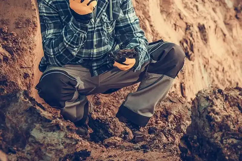
A rubber-tired backhoe or track-mounted excavator arrives on site and begins cutting a trench typically 1.2 m wide and 3 to 4.5 m deep, depending on the water table in Orange. The operator works methodically, benching the sides where necessary to maintain stability, while our field geologist stands by with a tape measure, moisture meter, and a set of standard reference cards for visual-manual soil identification. Each exploratory test pit in Orange is logged continuously from ground surface to final depth, recording color changes, plasticity, presence of cobbles, and any groundwater seepage. Soil samples are bagged at each stratigraphic change and transported to the lab for classification of soils using ASTM D2487, ensuring the visual field description is later validated by laboratory gradation and Atterberg limits. This direct observation method remains irreplaceable for detecting thin layers, old fill boundaries, or utility conflicts that blind drilling methods would miss entirely.
Direct visual observation of soil strata in an test pit reveals thin clay layers and old fill that SPT borings commonly bypass.